
.png)
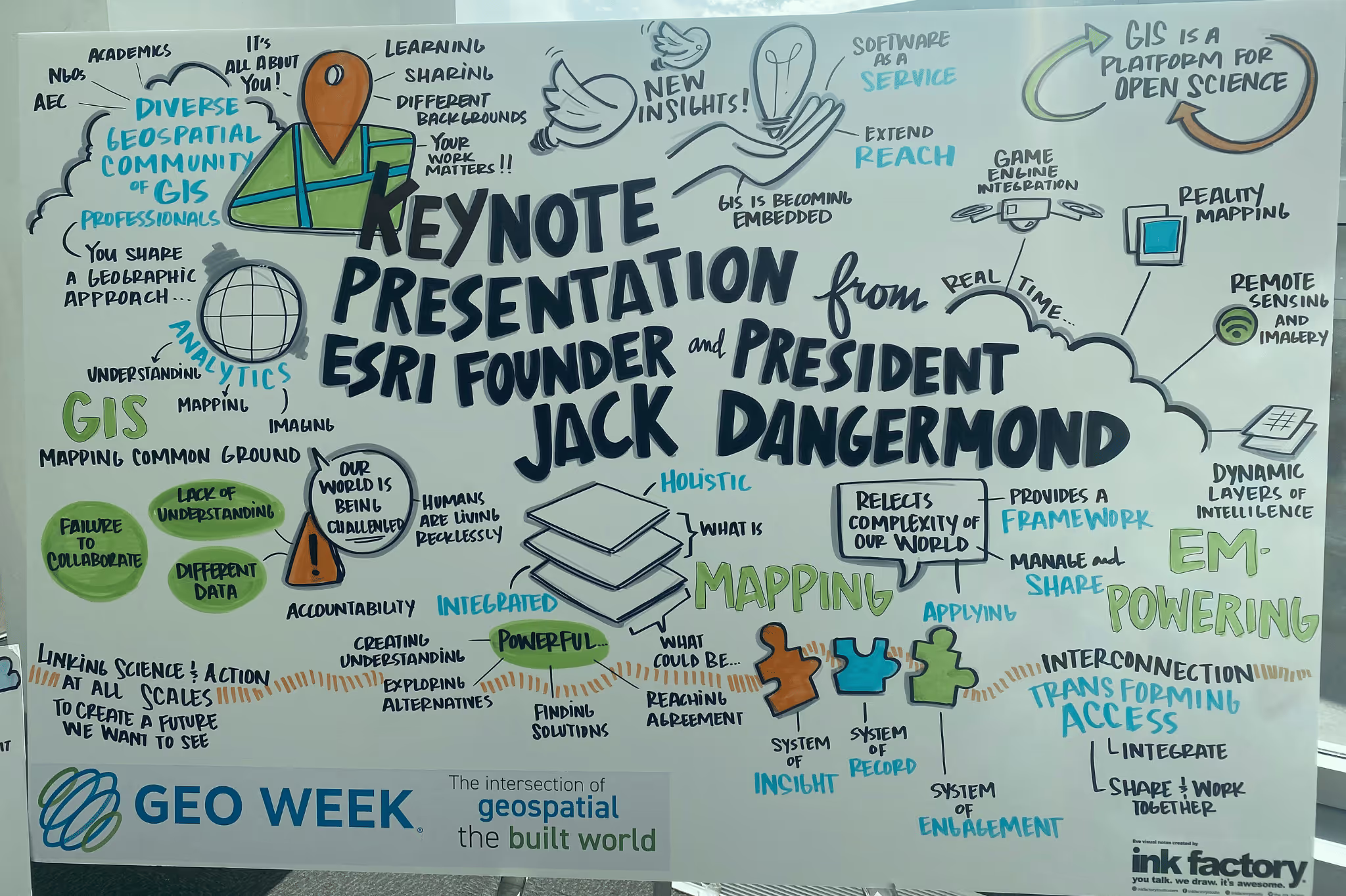
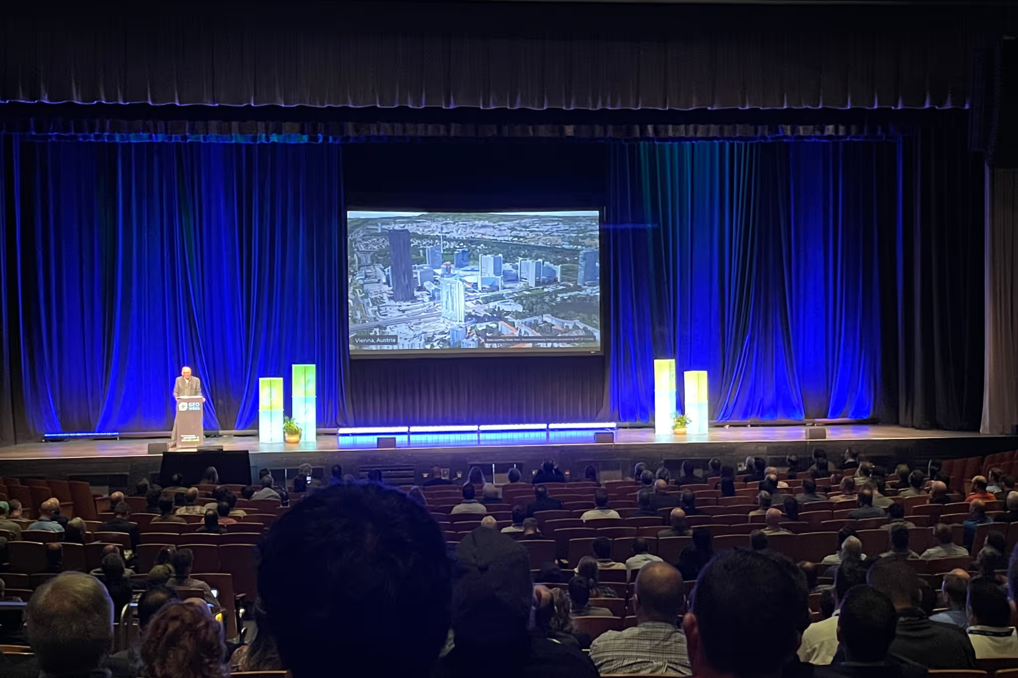
HFA team members recently collected exciting intel about digital trends in AEC at Geo Week, the premier event for increased integration between the built environment, advanced airborne/terrestrial technologies, and commercial 3D technologies. Shane Hevelone, MEP Program Lead, and Joshua Steinert, Scoping/Scanning Lead, shared with us the highlights from the event and their personal interests in current and emerging digital trends in the AEC industry. The main question of the week, as apparent in the keynote session, was around how willing and ready the industry is for adding new processes and technology into AEC projects.
Q: What were your main takeaways from the Geo Week experience?
Shane: Being new to the industry, I was excited to learn more about the latest technology, best practices, and advancements at Geo Week. It seems that the days of using traditional scoping methods to collect as-built conditions are numbered. Laser scanning has evolved and is becoming the industry standard for collecting data and improving efficiency and quality. It was interesting that many attendees indicated that they were adding scanning as a service in house versus being a service provider.
Joshua: I was most excited to connect in person with many of my professional connections and to see how industry professionals are combining and sharing usable information more effectively. Geo Week showcases technologies that touch every industry. Many of the tools used for decades were not only extremely expensive, but are also limited for very specific uses. Today's Geomatic industry is rapidly converging where cost effective procedures overlap everywhere and we are ready for a cultural shift in how we share information. Many conversations touched on how to track value and keep moving forward in adoption or rolling back pilot programs, and I enjoyed learning about concepts that we're actively using at HFA, including laser scanning, the digital twin, and reality capture. We'll continue to monitor the pulse of ever-changing technology, then test- thru pilot programs.
Q: What was the hottest topic at the event?
Shane: Digitization of the AEC Industry and smart cities. We heard a lot about the use of scan-to-BIM software and model/point cloud comparison tools to create a digital twin to help bridge the gap between the physical and digital worlds. Performing laser scanning during construction provides the owner with a true as-built condition, and can ultimately save money by holding trades accountable and assisting with long term maintenance.
There was a lot of discussion surrounding mobile and aerial scanning to create smart city digital twins; the smart city models can be used for infrastructure planning, population growth, and allows the stakeholders to be immersed in the metaverse.
Joshua: There were a lot of conversations about digital processing tools, as well as Building Documentation. Many industry professionals have avoided terms like the Digital Twin or Metaverse for the last few years. Now there is proof of the value of Reality Capture and Building Documentation because of the virtual revisit value and multimodal opportunities. I see this as increasing access to the Digital Twin of built environments, and equally increasing industry inclusion.
Q: Were there any other innovations that piqued your interest?
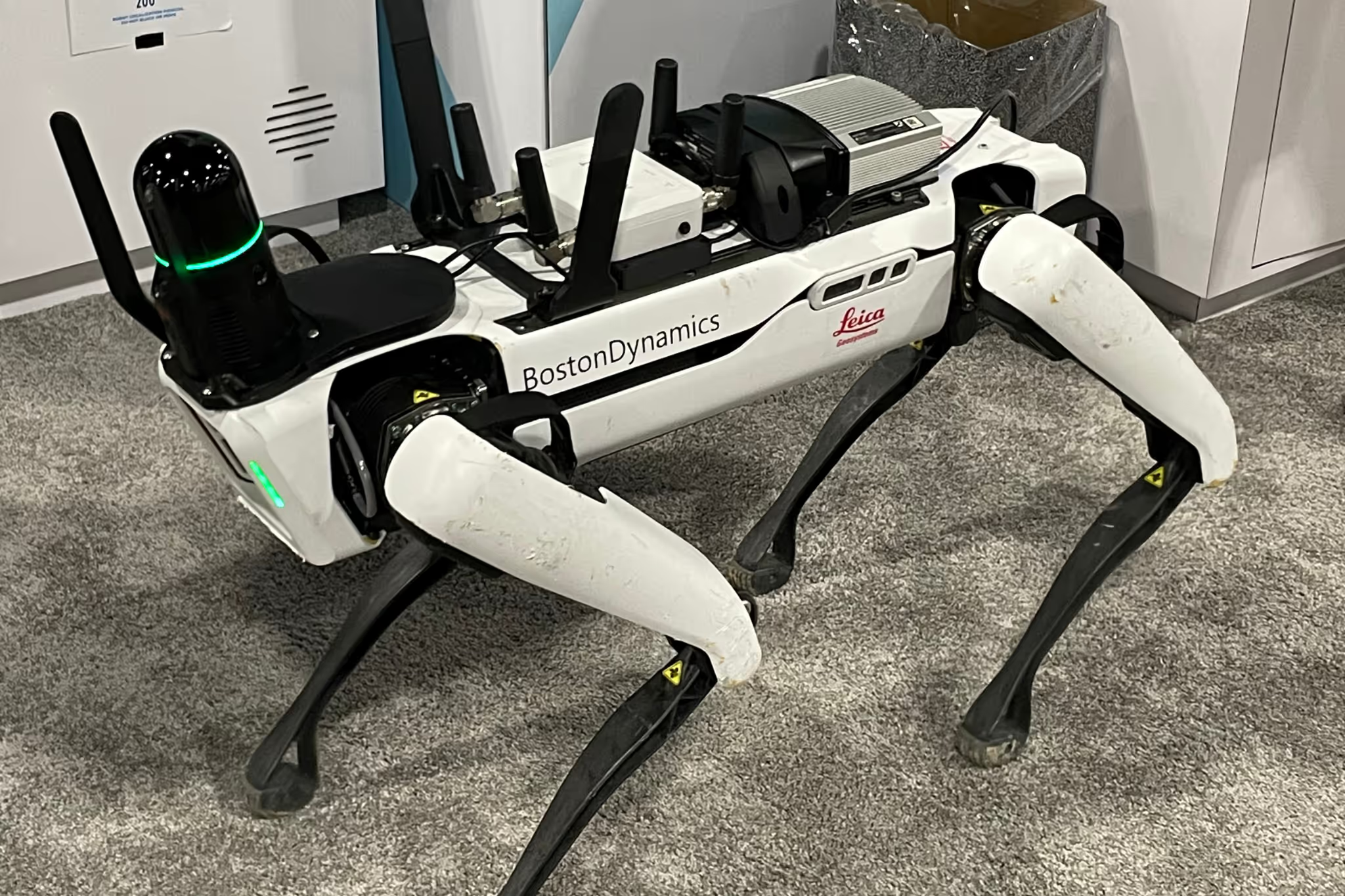
Shane: Reality capture is really evolving; it was interesting to see how laser scanners are being incorporated into technologies, both new and old, ranging from terrestrial (tripod) to mobile (handhelds/wearable) to drones, and more. We're seeing many improvements to mobile scanning for improved accuracy and speed. Applications and software are also getting more sophisticated; you can now use consumer- 3D cameras and iPhones to create point clouds and panoramic walkthroughs.
Joshua: I'm drawn to innovations that embrace degrees of freedom with decoupled systems. With the amount of government spending on infrastructure, the connected technologies from large scale cities that have to handshake with ADA use cases show the interoperability needs of all scales of data. Then, Private-Public Partnerships (PPPs) encourage the economy of sharing data beyond normal strategies. This is all very exciting!
All in all, Geo Week fueled the excitement for HFA's approach to building a bridge between the digital and built environments in which we work for our clients. Our studio is proud to be fully-integrated and highly collaborative, and we can only do this by continually testing and improving the digital tools and processes we implement. Thank you to Geo Week for the experience and to Shane and Joshua for bringing their learnings back to HFA.
For more information on 3D Laser Scanning, reach out to: Shane Hevelone at shane.hevelone@hfa-ae.com.
'


.avif)
.avif)

